EO4GEO EO data exploration and analysis tools
A cloud-based environment for EO data management and training offered by VITO

PROBA-V MEP and Terrascope platform were initially built with funding from ESA and BELSPO. In the context of the EO4GEO project, VITO made further improvements to the platform such as adding the ability to login and use the resources via the EduGAIN federated identity provider. Scalability and performance were also improved to be able to support simultaneous users in a classroom setting.
During the project, the EO4GEO EO data exploration and analysis tools were used in various forms. Many training contents were developed using the notebook functionality which relies on the EO data that resides in the platform. These notebooks link to various BoK concepts and offer the capability to link to learning management systems, which makes them ideal for educational purposes.
The platform was also used in the EO4GEO summer school, allocating virtual machines to students so that they could work on their use cases using the pre-installed tools and data that are readily available.
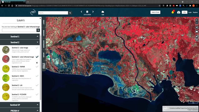
Explore satellite images and derived products with the Terrascope Viewer
Usage
The general public can take advantage of the free tools and the data. If they only want to explore the satellite images and derived products at a high level, they can make use of the Terrascope Viewer. If they are more into hands-on research and development or want to learn about processing EO data, such as classroom environments, they can use virtual machines or Jupyter Notebooks or make use of data catalog APIs.
Platform tools
Terrascope Viewer
- Explore satellite images and derived products
- See land cover changes
- Compare different layers or different dates for the same layer
- Look for trends in areas of interest
- Create time lapses
- Download data
Virtual Machines
- Fully prepared virtual desktop environment offering powerful tool set and libraries for further data exploration and analysis (using e.g. the SNAP toolbox, GRASS GIS, and QGIS)
- Direct access to available data archives
- use develop-debug-test applications (in e.g. R, Python or Java)
Jupyter Notebooks
- A web environment on the Terrascope server in which you can work directly with satellite data.
- Start with the data in the programming language you are familiar with.
- Easily track and export the data you need in the code.
- Do not just work in the code, but also add information about the code.
OpenEO
- A standard API to process the EO data in a simple and unified way to reduce complexity
- Work with datacubes.
- Provides out of the box functions and processes tailored for EO.
- Readily available via Terrascope Jupyter notebooks
Interested?
The Terrascope Platform is developed by VITO All these tools are available for free however OpenEO usage will be subject to a fee in the future. Users can purchase subscriptions through EOplaza (which is the Terrascope marketplace) or via the OpenEO Platform. Users can also seek funding for these resources through European Space Agency’s Network of Resources (NoR).
Accesss the platform
Subscribe to our newsletter
Keep yourself updated, receive SPACE4GEO Alliance news and info on new opportunities.
Join the SPACE4GEO Alliance
Be part of the SPACE4GEO Alliance and let’s discuss and work together on the supply and demand of skills in the EO/GIS sector. Stakeholders in the EO, GIS and Skills sectors are more than welcome!
Join a Network pooling together expertise from academia, VET providers, company, public institutions, research centres and sectoral associations with the common goal of fostering skills development in the space and geoinformation downstream sector.